Posted by: quienessupa | August 2, 2009

50km Triangle World Record

Atos, Zippy, Woodstock, Russell df

Zippy buzzin tower

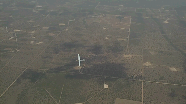
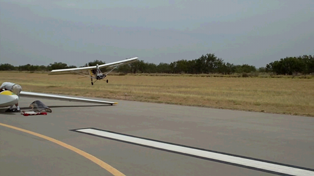
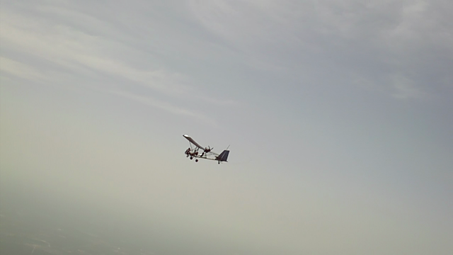
Above:  Zippy buzzing us.

Zippy Launch, Woodstock

This whole Keelometer stuff is hard on me’noodle.  But here’s what I think it tis.

Speed to beat:  40.8km/hr

Time to beat:  1hr 13min 30sec

In my attempt on 7/19/09 here in Zapata, the winds were abnormally light for this place.  About 8mph from the SE.  The clouds powered up and got taller, wider and more prevalent as the afternoon heated up. 

flychart 50km trklog

First lap: 00:56:28 (hh:mm:ss) which resulted in a 53.13km/hr average speed.

Second lap:  01:00:39 (hh:mm:ss) which is about 50km/hr average speed.

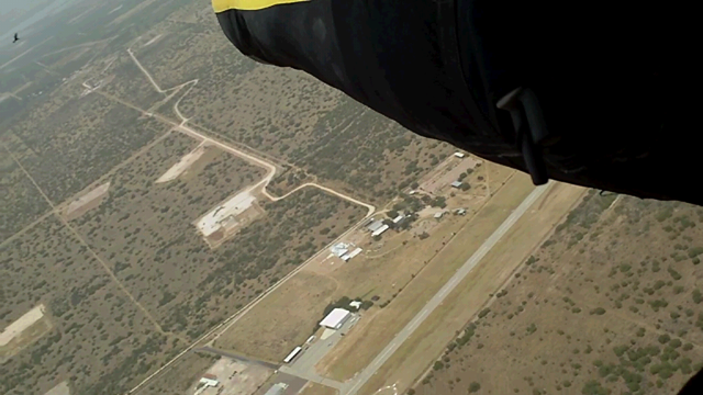
Below Pic:  Mexican Eagle.  The birds down here are super helpful.

Mexican Eagle over Zapata

Difference in height from start to finish needs to be less than 2% of 50km.  So, .02 times 50km is 1km.  That’s 3,281ft.  Unfortunately on my first lap, I got back to Zapata airport 140ft shy of that minimum.  Huge bummer. 

hotdogs meet mesquite

Tonights Dinner.  Used Mesquite in the BBQ grill.  That stuff burns too hot.  I really miss Gwen’s cookin.

Just in time, Gary Osoba mentioned that he thinks conditions are getting better and better which convinced me to try another lap.  While this time I was slower, I made it back to Zapata with about 1200ft to spare. 

SeeYou 50km trklog

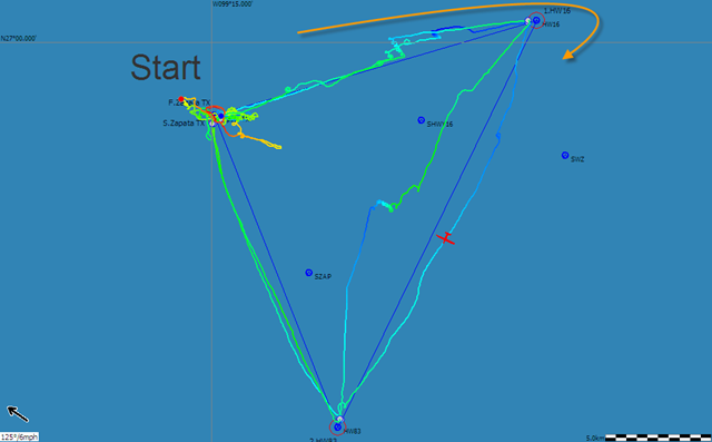
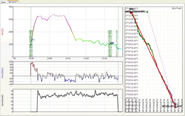
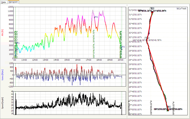
Above is the SeeYou tracklog.  The red plane is on the first lap’s track.

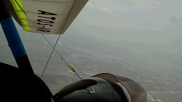
I remember hitting enormous lift on the downwind leg, which was also the last leg.  I pulled in and was well past the speed limits of the sky and Atos going up like nuts.  There was a 2 mile section where my averager showed 400fpm lift while I flew from 38-55mph (ish).

Woodstock in flight

Woodstock atos wing

Russel Landing by Woodstock So, I’ll submit the 2nd lap for a new 50km Class 5 World record.  2 new records in the first two flying days of Zapata and I’m jazzed.   That was about 2 weeks ago.  We haven’t had a classic distance day yet unfortunately.  We’ve lacked the morning moisture that turns into low cloud streets at 9-11am-ish.  Nice clouds in the morning a few times so I can imagine what it gets like.  We’ve had some wind but there have been fronts up on course-line that create headwinds 250-400 miles out.  Tomorrow is the first forecast I’ve seen in a while that has tailwinds along the entire courseline up through Big Spring.  Not as strong as we’d like but I’ll take anything close.  I’m fine with blue day attempts at this point.  Get’r’done. 

Wish us luck!

Posted by: quienessupa | July 30, 2009

Paying dues in Zapata, retrieves and Garmin Rinos

Yesterday (21 miles) and the day before (17 miles) were those days when you go for it early and roll them dice… go all in…  se la vie…  caution to the wind.  They’re still an adventure to me but it’s hot!  It’s 100+ every day and out there in the wind, cactus, mesquite, all by my lonesome, it’s a reminder how small I am!  Rich experience and a small price to pay for this Zapata newbie if you ask me.

Though yesterday wasn’t hundreds of miles, I landed with the feeling you have after your first cliff-hanger ride (6-flags).  I had just drifted over sketchy LZ challenged land for 8 miles.  It started at 650ft over the ground, but I had sunk to just 230ft and climbed 200ft above that before succumbing to terra firma.  It was fantastic.

tracklog

Then, luckily, for both of these retrieves, I’ve had gas field workers help us get through locked gates and show my Dad where I am.  A land owner named Rick Walker personally helped us with some gates.  He had flown his own helicopter into the airport to say hi to all us HG pilots at the beginning and has been loaning Russell his experimental airplane to commute in every day from the ranch he’s staying at.  Pretty cool. 

Maddies first Baby Einstein My kid.  Miss her.

The Rino’s are working AMAZINGLY.  Dad’s super sold on them as I don’t have to keep radio’ing my distance and bearing constantly because he just “polls” me and see’s my exact location on the Garmin map, which also instantly shows exact distance between us and direction to me.  On the 302 mile flight last week, we had a max distance of 45 miles from which he could receive my coordinates like this!  They say they have a max distance of 14 miles under perfect conditions.  When I transmit coordinates to Dad, he almost always gets them 20-25 miles away.  When the ground unit (dad) polls me, 15-20 miles seems to always work.  Past these distances, we’ve seen some times they don’t make the distance depending on my altitude and his ground cover.

Later,
BJ

Posted by: quienessupa | July 27, 2009

Zapata Update

Zippy has a parachute!  Not just the back-up we hang glide with, but he’s a full on skydiver and base jumper.  Dude.  vlcsnap-28399

Above: Zippy crawling out on the wing struts.

Below:  Zippy bailing off!

vlcsnap-29016

Search for “Lover’s Leap skibase” on youtube for a cool Zippy/buddies base jump.

vlcsnap-24160

Dad’s running my wing.  He kept a nice gust from pulling it up right when we started thank goodness. 

vlcsnap-56536

Dustina Martin did a 100km triangle at 49km/min today breaking the previous 44km/min speed record.  I tried too but got low after the second turnpoint and then the wind just worked me over bad so I was happy just to get back up.  I flew for 3.5 hours playing with the clouds and driving over to Mexico on Air-BJ.  Then around Zapata and back to the airport.  Ended up being 55 miles of exploration.  The clouds came back today around 1pm and we’re all excited for tomorrow.

Also, Zippy took Laura up for a tandem and it sounds like they had a blast up at cloudbase. 

302 flight flychart

2 days ago was a 10 hour, 302 mile flight that I’m dang proud of.  3 clouds for the entire flight.  One I got past the hill country and up to the higher plateau, I got a climb to 11.3k, but it was just too slow.  My tailwind was showing 17ish when I was low and a couple times showed just 5mph when I was high.  For 3 days, the wind has been all backwards…  22mph on the ground, but 5-8 up at 10k.  Weird.  Tomorrow and the next week show promise of making real wind all the way up to cloudbase which will help a BUNCH.  And we might also have clouds!  GAME ON.

I’ll try to write up the 50km triangle sometime.  Busy. busy here.

Posted by: quienessupa | July 21, 2009

Zapata is the chosen land!

vlcsnap-53586

This place has given us incredibly enjoyable flying at cloudbase for the first 3 days.  Day 1, the tug arrived at 1 and they hussled it together so we could take to the skies.  I was first, and was a bit hesitant b/c I’m still anxious around aerotowing for some reason.  Anyway, forgot to buckle my outside buckle and then, the zipper blew out so I’m towing up with weird thoughts and strange feelings hanging by my armpits!  Anyway, got it buckled after completing the tow and then I could relax a bit.  Needed to adjust my new helmet suspension thing too b/c it was a skosch tight.

vlcsnap-43949

But it was perfect to get a late day flight to test out that and the Garmin Rino’s.  Got to cloudbase in the first climb and then the sea breeze came in.  Gets windy like a cold front but this was maybe maxing out at 22ish on the ground.  It just wipes out all the lift.  I enjoyed the liftless ride down from 8 or 9,000 ft.  And the view.  And the 68 degree temp up there, while it was over 100 on the ground!

vlcsnap-47899

They say this place always has a strong S wind.  And on the second day, our launching towards the North was the second time Gary can remember them launching that direction in 9 or so years.  And these conditions haven’t been all that great he says.  Dustin said it too when he got there yesterday.

Davis emailed the waypoints around here to everyone and helped me figure out which one’s were FAI 25, 50, and 100km triangles.  Beautiful.  So Saturday, I set off to try getting the 25km triangle and to get familiar with the area/thermals/clouds.  I flew around it as many times as I could, learning ways to make it faster.  First circuit was 41 minutes around.  Not the 30 minutes I needed and it was a little depressing.  But the day and the clouds and the cloud streets kept building.  By the 3rd circuit around, I was able to avoid making more than just a few turns and screamed around the course in my Atos VR.

25km flychart

Hindsight is 20/20, but I could have burned more altitude via speed on the way back and I could have omitted some/all of my circling.  For a 25km triangle, you have to return to your start point no less than 2% below or 1600ish feet.  I think I could have shaved a minute off my time.  Looks like I did the 25km in 27:34 at 54.6km/hr.  The record was 50.4km/hr.

More to write and talk about.  The next day was a new record too.  Not flying with the video cam unfortunately but I wish I could show you guys what it’s like to have Gary Osoba running aerobatic’s in his Woodstock all around you as we finish the last 400ft to cloudbase.  Magic.  Kent Robinson joined us in a thermal too.  That guys a riot!

I need to get some rest.  Later…  Sorry no pictures, my “Snag-it” program isn’t taking the screen shots right!  I’ll get some great pictures out here when I can.

Posted by: quienessupa | July 21, 2009

Garmin Rino 530Hcx results so far

FILE0008

3 days of flying and probably 7 hours of time trying these out and here’s the observations so far.

FILE0007

These radio’s transmit their GPS waypoints every time you push the PTT button.  There’s also another button that just sends the current GPS location without engaging the microphone.  Either way works the same.  Here’s the real cool thing…  One unit can “poll” the other unit which means that a driver can just “poll” me and find out my whereabouts without my ever having to reach for the Rino that I’m flying with. 

FILE0003

The reason I like that is that I’ve mounted my Rino in a LOW drag spot behind my elbow, and while I can reach the button’s fine, it’s nice to NOT have to put another draggy thing on my control frame.

FILE0005

The results have been good so far.  My Dad (driver) has been able to poll me and get the resulting coordinates 90% of the time.  I say that because when I was 9-10 miles away from him yesterday some of his poll requests didn’t work out.  Still though, 90% is good.  Also, when I reach back and hit the “send coordinates” button, he’s gotten my coordinates every time.  I believe that will be what I need to do as I get farther away since I’m up high, I’ll be able to send my signal out LONG distances where as I can’t see his signal from the ground as easy.  He was also inside my truck when the polls didn’t come back.  We’re pretty happy with them.  Each time my coordinates refresh in his unit, whether he polls me, or I send it out to him, it puts a smiley guy with a baseball hat on my latest waypoint and updates his “goto” to take him there.  It also keeps my previous locations on his map as a little tracklog so he can see my progress.

Pretty cool..  The big tests will be open distance which we’ll have to wait for the right day.  Today is turning into another triangle attempt day.  Going to set up a reasonable 100km triangle.  The wind is strong(15-20) SSE below 2kft and on the ground, but supposed to be very light up above.  So if I can get high but make my final leg downwind and low, I think I could get a 3rd triangle record.  We shall see. 

Happy flyin

« Newer Posts - Older Posts »

Categories