
The first snow of the season still held onto the 13kft peaks of the Gore Range. The sinking sun had painted them a deep red with the same brush that rendered my wing this new color. It was fantastic, but I was running late. Burning almost a mile of altitude to land before dark was proving unusually difficult. The usual sinky air I’ve come to expect over the lake wasn’t there, it was lifting everywhere. Sure, sounds like a typical glass off, but typical for me, here (in a flex wing), is glassy air for a mile out from the ridge, then sink… But this evening, I drove upwind for 6 miles and crossed the lake and then met the rising, lee side of the Gore range, where I was sure I’d find sink, but I just couldn’t get below 12k. I was blazing 50+ for a long time, even with full flap on the VR! DUDE! THIS IS AWESOME!! When the sun disappeared, it left a long line of red-magenta along the Western skyline. I can’t really see with the visor down anymore and it’s really COLD to open it at 12.5k. My Oxygen tapped itself 30 minutes ago and the inner voice that’s saying “Get the F’ Down” has gotten hold of a megaphone so decided to try something new. I blazed downwind 6 miles (losing only 89ft in 3.2 miles and 5 minutes at 50mph) back to launch and to the lee side of that mtn where it just took about 4 turns to loose 1kft, and then another 1000ft, and I was finally under the lifting layer at 10k. Thanks for the suggestion Steve!
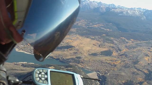
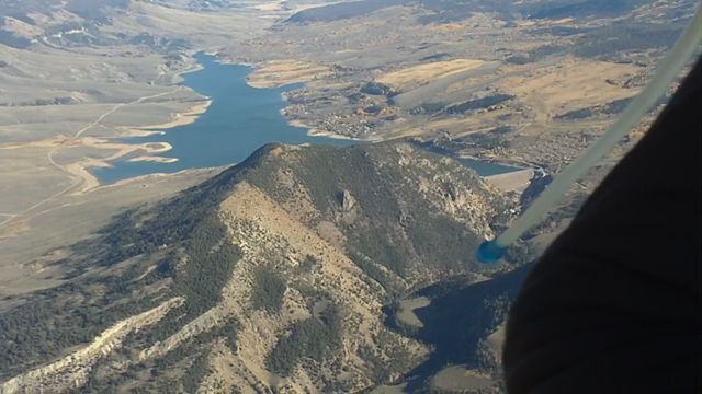
Picture of the Gore and Green Mtn Res below:
If had been efficiently flying in the glass, I feel sure I could have climbed over the ridiculously big Gore peaks, but the stars would be out by the time I’d get back to earth… What a Super nice Glass Off, maybe the 2nd best I’ve experienced ever. Sorry, video cam battery died before the glass so this will remain legend…
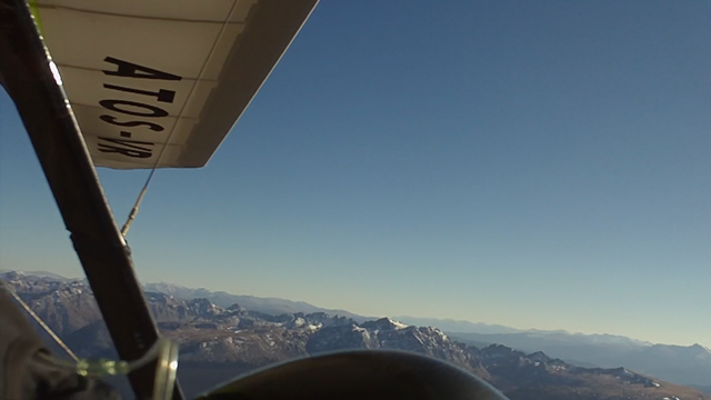
OK, the day was a the tour of a lifetime for me… Here’s a minute after launching:

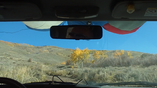
It was a strong classic Fall day. Steve and Matt helped me get the 100 lb Atos through the forest to launch and conditions were cycling in with lulls down to the 5-10mph range.
The video cam was off, but shortly after launching and getting up to Matt and Steve, a plane came by probably 400 below me, 300 above Steve and then above Matt! The West wind was moving about 20mph at 12k above the ridge and was ‘textured’. Once leaving the ridge, it was only 15ish all the way to 14k.
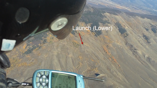
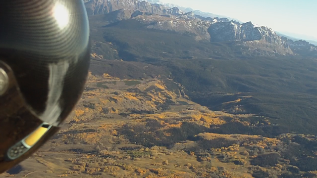
Find Matt in the picture below:
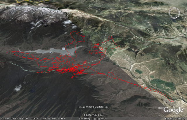
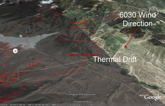
A cool tidbid of knowledge was gained from Steve and experience today about how some compressing air over a ridge is accelerated and makes the thermals more blown apart and hard/unnerving to climb in. The VR let me drive out front over the valley and in doing so, it was very apparent on the 6030 how there was an extra 5-8 mph headwind over the ridge vs. out in front. The air was noticably more turbulent than the valley. I got bounced once and it reminded me to grab my parachute handle once in a while to practice the motion. My lizard brain actually went for my chest which is where it was on the old harness! So, it’s a good exercise for the instincts! Cool Google Earth overview of the flight below:
Early in the day, when the wind was strongest, I followed a sweet lift line straight upwind. In the Atos-VR I could go 40-45(airspeed) and still not loose too much altitude. It was fun trying to stay in the best line of lift. Strangely, the thermals drifted perpendicularly to the lift line. So as I exited each thermal, I would be in sink, and would head back North and hook up with the lift line again. This didn’t make sense to me b/c I thought lift lines were parallel with the wind direction. The 6030 wind direction agreed with me that the wind was from the West, but the thermal drift was as if it was NW (I think the 6030 and I are crazy). Anyone know why this could make sense? Illustration below show’s the drift big time:
Still pushing upwind, I finally hit the sink associated with approaching the lee side of the Gore. I was hoping this lift line would get me to the windward side in a saddle of the Gore, but I couldn’t get high enough to justify getting closer in the strengthening sink. Bummer, but totally new territory for me so it was awesome! Illustration below:

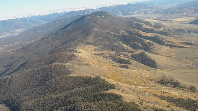
Fruit of that labor (looking South):
Flying at Williams after avoiding it for so long, and coming back with a ridiculously powerful machine to fly under made this site really open up to me. Getting to cover so much ground while practicing feeling out lines of lift was fantastic. When I was over 13, I could talk with the PG’s and HG’s flying Wolcott. Since some PG’s were flying, they had tamer winds out West. Heard them talking about speed bar though.
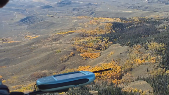
Cool Shot of the rocky parts of the Gore Range/VR:
A few miles shy of making Kremmling in the Below Picture, looking back towards Heeney Res and the Gore (by the time I cruise back to Heeney, it’s getting real glassy. Long shadows already):

Below, Looking North at the huge amounts of yellow from somewhere over launch I think:

Here’s my favorite shot of the opposite side of the valley from over the Reservoir Dam I think (I’ve got to get over those peaks someday!):
Late in the day, as I’m buzzing back towards launch in the dark to get lower, Steve and Matt turned on their truck headlights so I could spot them driving down. The landing was fine, although downwind at upteen thousand feet. Still flared enough to get my feet under me, just barely!
Also, taking the first few turns in the Atos-VR was shocking b/c I’ve gotten real dialed into my Sport2. The Atos doesn’t want to whip around during any part of it’s turns, which I was forced to remember. It likes big turns and to be driven around the sky. Forgot all that. Huge thanks to guys like Steve that impart such valuable experiences/knowledge every time we fly together. Till next time!
Flychart Says:
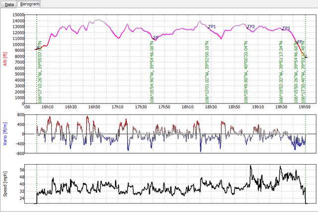
Airtime: 3 Hrs 51 Minutes
XC: 37 miles
Max Alt: 14.2 kft

nice pix… ahhh, Heeney Res is actually named Green Mountain Reservoir.. FYI
Happy flying!
mark (kremmling)
By: mark on October 14, 2008
at 5:25 am