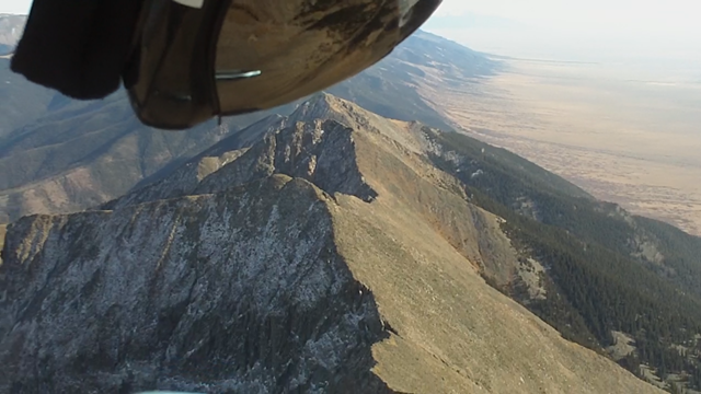
The thermal cycles were cooking past launch, and the RC plane could still soar in the lulls so most of us waited for it to lighten up before taking off. Reports from flying here all week sounded like it’s been spank-ville. Shawn was 1st up and off and put the quarters in the washing machine. Ready for some cleaning myself, I was off next at 3:15 and then I think Steve in another while. I launched between cycles, and cruised to another ridge further south before coming back to launch to hook my first thermal. Fred had announced it’s arrival at launch and when I buzzed over, sure enough, it was about 500fpm to 12k. Here’s a picture of launch as I’m climbing up and out.

I left my top zipper open above the keel on the Atos-VR and was hooked in going to launch before Fred pointed it out to me. I’m bummed I did that and will change my process. VG saved some special air for me between 11.2k and 12.2 as if to punish me. For the first 1.5 hours it was like VG had me over her knee.
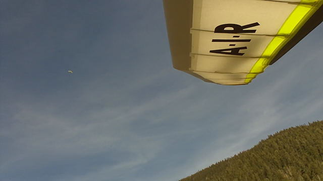
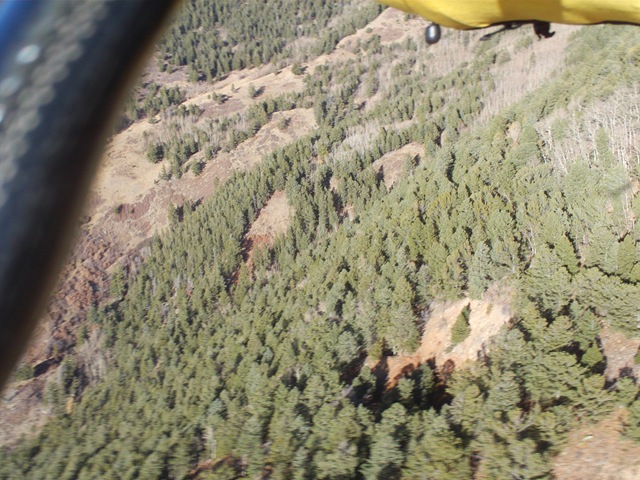
Below is a picture of strong sink in an unfamiliar valley many miles N of launch… The thermal here would send me rocketing up for one second and sinking like this the next. It didn’t overpower my will to keep the nose down, but it was a rich experience with clarity in every instant. Diving sideways, ripping back up and trying to turn in it, but never more than half a turn before the meat was gone. The VR feels happy in this stuff.. Although this might have been a fun one to have my flex wing to try getting on a wingtip to spin up in the tight core.

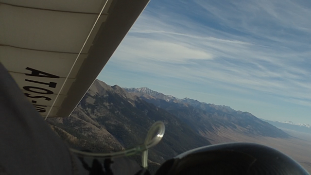
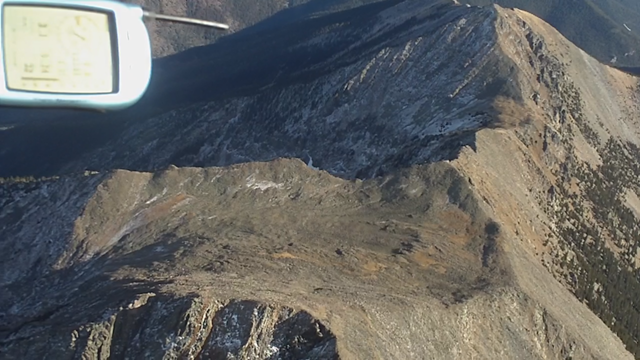
I remember other days when the wind was SSW or S and the air was also pretty bouncy. Since the strong wind is hitting the Sangre De Christo’s at an angle, it’s pretty hard to be close to the hills and remain out of the lee side rotory air of the next ridge/spine upwind. It took full attention to my changing position to avoid getting in severe lee side rotors. Below is an earlier picture of Capt’n Shawn, way up there at the top of the pot!
Maybe it was the High Pressure, but the thermals didn’t really exist much out in the valley or over the lower peaks. All my better climbs were from thermals that were squirting up against SSW facing mtns/ridges. As Steve said, I think the Mtns were acting like a chimney above a pretty robust inversion. Gliding around at 12k looking for lift felt like I was a little toy boat riding a pot of boiling water. That changed later after the sun sunk to the ‘simmer’ setting and the foothills began lifting off more. Not getting high made for classic late ridge running and some great video. Looks cold on the NE side below!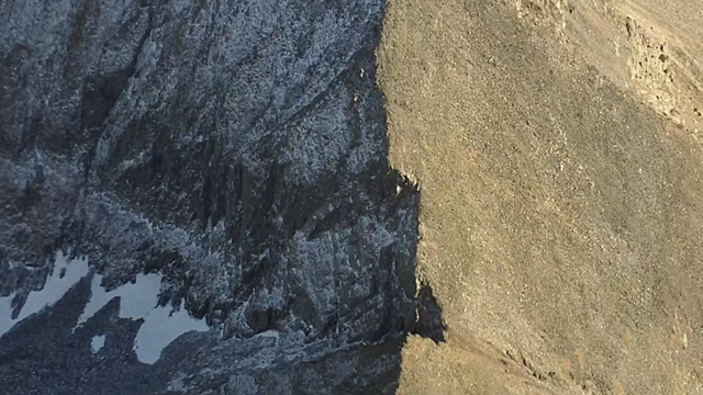
Below, Looking South from 7 miles N. of launch.
Below, Looking North from the N. end of the Sangres. The white chalk cliffs in the distance are near the base of Princeton. That’s “Mission 2009”. The highest alt gain of my life was last year over the big peak in the foreground. Alpha plus 2.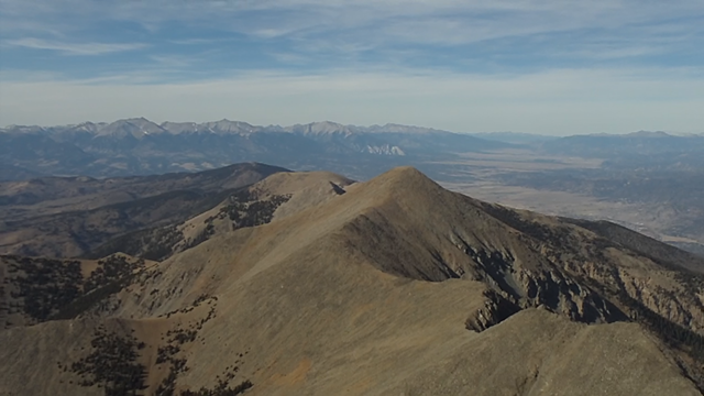
After zooming 7.5 miles N of launch, coming back was a tough challenge! The S wind was making it super difficult and once I got low on these peaks, I knew I couldn’t let myself get down in the lee side of the ridges that extend out in the valley. So I kept going out in the valley and getting lower and lower. Great video of the bar-fight I had with some thermals to get back up. I’ll get video together this winter. More pictures..
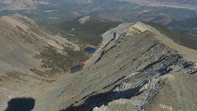
Above: The 3 lakes over the back looked inviting..
Once I got back, everyone was in the air. I joined up with JY and we blazed South as far as we dared. A few ridges past the bat caves was all we could muster as it was a constant state of entropy. I thought my goose was cooked down over the bat caves as I’m able to see down inside them. Here’s a 4 minute video clip of the scratching and the thermal that got me out of there and back to 11k. It was a rewarding save that made the flight worthy.
Video Link to bat cave scratching: http://vimeo.com/2013599 (Sorry no editing this time but it’s the original .mov file and has great HD quality (4 minutes)
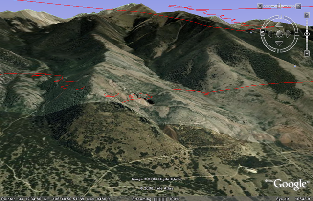
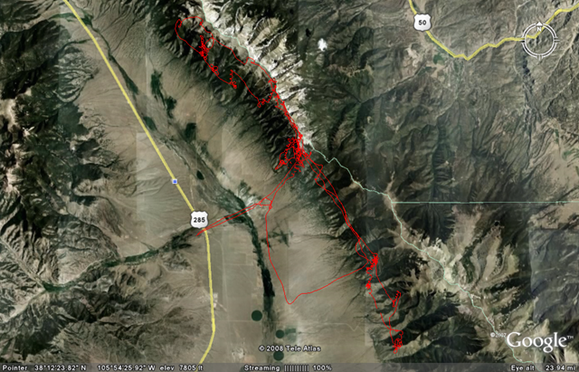
Above is the google Earth view of the bat cave scratching. My tracklog often disappears in the terrain which is too bad. Am I suppose to recalibrate the altitude once in a while on the 6030?
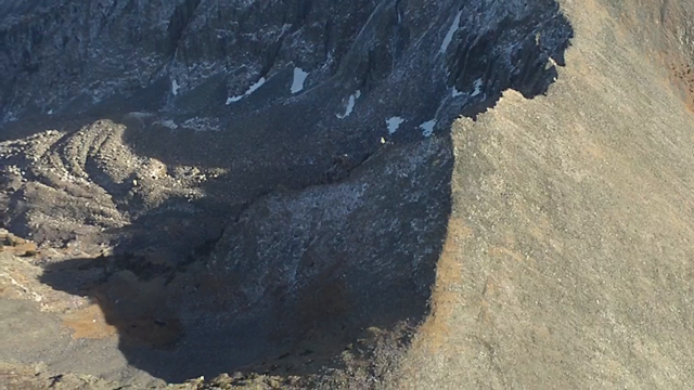
Below, I accidentally took this picture of the hidden bat cave entry/exit down in the trees! You can see it at the end of the video too. I believe these bat caves are an old caved in mine? Anyone know the 411 on it?
After winning that battle, and zooming back over launch, the air was nicer and I negotiated yellow rain. Then we tried to play catch the plastic bag at 12-13k. After I let go of it, and turned around, I never saw it again. Bummer.
Here’s a video sample from the knife edge of the ridge. Adobe PE4 makes the file bigger and takes lots of the quality out when changing to .avi (just 1 minute long)…
Video Link: http://www.vimeo.com/2018486
Below: Could I top land at 12.5k? There’s some interesting places here in flat spot between peaks. I’d love to be able to top land and hike around undiscovered territory and relaunch someday! Man, but what if I broke a downtube up there… holy shit sandwich batman… There’s a glider in the top right of this picture…
Next I ran the ridge N again real close for a couple miles before Fred and I decided to try and fly to Joyful Journey Hot Springs for a warm-up soak (9 miles upwind). That plan almost worked, but beer suck and the thought of landing out sent us careening back downwind to Larry’s house. I cruised over the LZ with 900ft and then shadowed a BIG black/brown bird as we both climbed up the ridge. He was looking for food in the pine’s below, and I was enjoying just watching him OWN the high ground over whatever dinner would be. He quit climbing up at tree line and I enjoyed the rest of the smooth late-day elevator ride to 13k again.
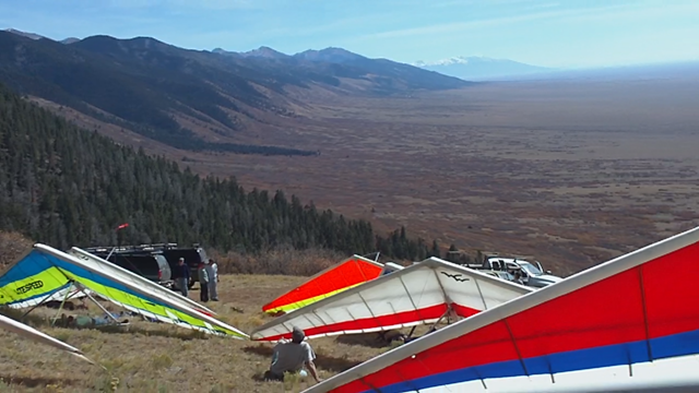
The sun was about an inch over the horizon now so I buzzed out over Villa Grove and beyond for 6 miles and then back to land by Tiff’n’Larry’s bon fire in their back yard. The Brats, Beer, and company was great. Everyone had gotten all they wanted for airtime. Even our new H2 had a great flight, getting to struggle low and then adding 2 hours of airtime to his log. Nice JJ.
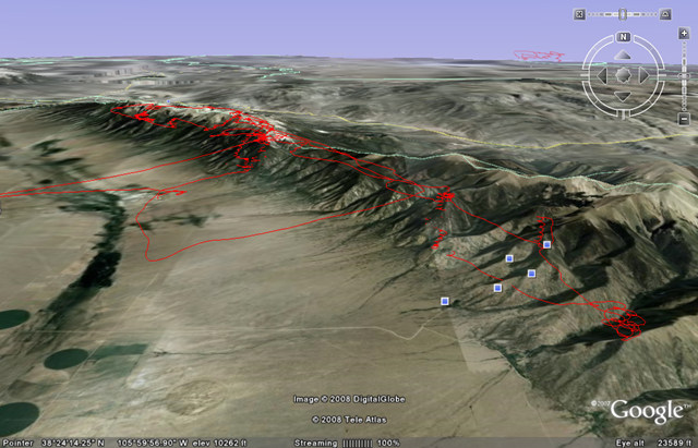
Google Earth overview of the flight.
Flychart says:
Airtime: 3hr 51 min (Same exact duration as a Williams flight 2 flights previous… WIERD)
Max Alt: 13.3k
XC: 63 miles


BJ – Great flight! Your Vimeo is set on private. http://www.vimeo.com/2018486 Please make it public.
Thanks, Jonathan
By: Jonathan AKA: NMERider on October 20, 2008
at 8:31 pm