Posted by: quienessupa | December 12, 2008

HD Video trials, lessons learned, and rewards

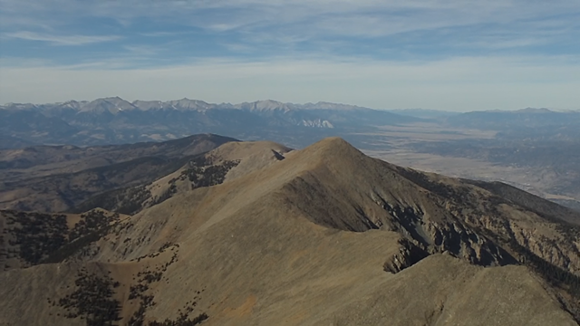
First off, the rewards, here’s 2 video’s I’ve made in HD.  B/C of lessons learned, they are as good of HD as what I get to watch in my living room.  I used to be limited in what I could put online b/c of youtube and vimeo file size limits, but youtubes limits have changed!  The previous video’s were also limited b/c PE4 was parsing down the pixels and changing formats and reshaping the pixels.  Read on for the nitty gritty.  The lookout video is all HD, the totinos one starts with some footage from a non-HD camera, but quickly goes into some HD.

http://www.youtube.com/watch?v=OvcCSQuXDAQ <–This is Lookout

http://www.youtube.com/watch?v=zyq8PhvQOzY <–This is Totinos Xgames video contest

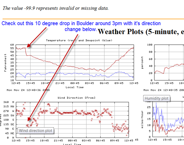
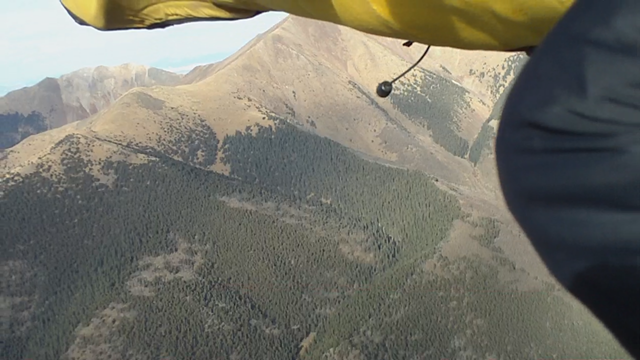
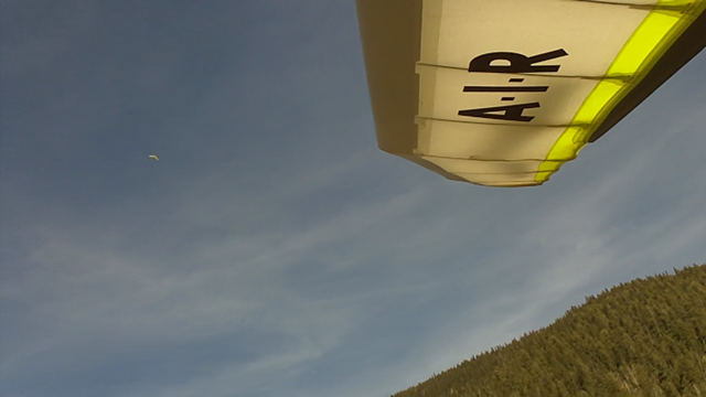
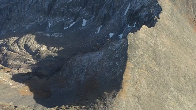
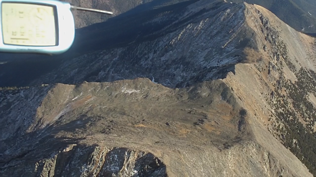
Below: Snow Closing in on me during the flight with a Totinos box.  What’s wrong with the below picture…(something very embarrassing)

Snow closin in

OK, I’ve been thru some serious trials and tribulations to get these movies made, but there are some lessons learned that could be very handy for anyone making movies out there, especially in HD.  Simple stuff first….

1.  Music:  Screw I-tunes…  All music bought there is encoded and protected behind M4P and generally speaking, no movie editing software is going to allow you to enter them into your project.  That includes Adobe PE4, PE7, Vegas products, and all others I checked.  Also, I tried a free software, http://audacity.sourceforge.net/, to change my .m4p songs into something else, but I think Vista gets in the way.  SO, SOLUTION = buy songs from www.amazon.com where they cost a buck/song just like I-tunes, but they are .mp3’s which work everywhere and hence can be part of a movie project.  I-tunes can pound sand.

2.  Quicktime Pro – I’m sure it’s great on Apple computers, but it won’t play my raw HD .mov files that come from my Aiptek HD video camera.  At least not smoothly.  I paid 30 bucks to upgrade from quicktime b/c the pro version was supposedly able to convert my .mov files into .avi’s which are universally more digestible for movie editing software.. especially Adobe Premiere Elements.  In spite of not playing smoothly, Quicktime Pro would export the .mov files into AVI’s after a good wait… however, they would always be terribly pixelated, discolored and sticky framed.  Very unusable.  Quicktime can pound sand.

3.  http://www.movavi.com/videoconverter Jim Y. has had success using this software to convert his Aiptek HD movie files into .avi’s but things weren’t working for me on my Vista machine.  Thinking that I had a computer issue, I had Dell Support help, and probably because of reinstalling video drivers, the movavi software said my 30 day trial period was up and I couldn’t play with it anymore.  (just downloaded it that day?)  So, I reckoned Movavi can pound sand too.  Since, strangely, PE4 started accepting .mov files again!

5.  http://www.codecguide.com/download_mega.htm The dell guy downloaded this for me.  All I know is that Adobe is working better than ever with the feared .mov files and this could have a hand in it. It has all the codec’s you could ever need and somehow oversee’s video decoding and encoding and gives some choices of what types of codec’s to use.

6.  H.264 codec.  Now that I know that my Aiptek HD camera encapsulates the .mov files using the H.264 codec, I can make sure that I try to export movies using the same thing..  So, now I tell Adobe to export “Quicktime” (which means .mov) and then in advanced properties, I can insist that it decode and encode the export in H.264.  I also tell it to use square pixels, therefore it’s not trying to make changes between it’s natural 16:9 size and 4:3 or any of the other type outputs it tries to conform to(by default).  Since youtube now shows 16:9, there’s no need to change it.  I believe that doing this helped reduce the computing burden on Adobe PE4 and no more crashes, so far.  This was big…  NOTE:  h.264 is apparently a complex encoding method and requires fairly powerful equipment to run smoothly.  My laptop won’t play my h.264 files smoothly.  At least the 60fps one.  My Laptop can pound sand.

7.  www.youtube.com BIG NEWS, Youtube now will accept up to 1g files as opposed to the 300meg rule.  They also are outputting 16:9, AND have a new option for viewers to “watch in HD” instead of just “watch in high quality”.  So, I don’t have to go to Vimeo and be limited by their 500meg upload limit to get HD video out there.  And Vimeo charges money to upload files as big as 1g.  Youtube ROCKS and is free.

8.  I uploaded a 964meg video to youtube here:  Click the “watch in HD” at the bottom right of the video player and pause it for a minute to load.

http://www.youtube.com/watch?v=OvcCSQuXDAQ <–This is Lookout (from top of page)

This video was shot in 1280x720p and recorded at 60 (59.94) frames per second by my Aiptek HD camera.  I “exported” from Adobe PE4 as an .mov file with those same stipulations so as not to loose quality.  Also, it seems to be common knowledge that whenever you change from one format to another that you loose quality.  Makes sense I guess, so I’m keeping mine in .mov and the resulted “export” really does have a lot better quality than my other exports I used to do.  Mostly because I think that PE4 used to default to lower “HD” pixel counts AND change files to different codec’s(I admit I’m talking over my head here).

9.  Adobe Premier Elements 4:  It had quit allowing me to import .mov files altogether, which is why I went down this road to find conversion software to change files to avi’s…  BUT, after the dell support work, for no reason, it starts working with .mov files again.  In desperation and against better judgment, I started a movie using raw .mov files in PE4 again and mixed in some .avi’s for fun.  It was just a 1 minute movie with probably 20 different spliced in segments and everything worked without a single crash…  Here’s the result.. you can tell what’s shot with HD and what’s old footage if you watch it in HD… 🙂  Trying to enter this www.totinos.com contest and join in the fun:

http://www.youtube.com/watch?v=zyq8PhvQOzY <–This is Totinos Xgames video contest

In conclusion, I’m taking back my griping about PE4 for now in hopes that my new method to keep .mov files .mov and to only export (encapsulate) using the same h.264 codec that the native file used will help me continue to use it without the crashing issues.  I’d like to know if someone with a vista machine can make the movavi program, or Quicktime Pro program’s convert HD .mov files into .avi?… Please write a comment to me if you’ve had success…  HD only though as I’m fairly sure it would work with non-HD for me.

My Computer details (b/c problems usually relate):

  • Model:  Dell XPS 420 running Vista Ultimate
  • Processor:  Intel Core2 Q6600 (2.4GHZ, 1066FSB)
  • W/Quadcore technology and 8MB Cache
  • Memory:  4GB 800MHZ DDR2 4DIMM
  • Video card:  Nvidia 8800 GT
  • Hard Drive:  1TB 7200 RPM Serial Raid0

I hope this helps somebody… I’ve spend to nights up till 3am on this stuff.

BJ

ps… Next couple blogs, how to take care of red tape before attempting a world record, and Totinos X Games contest, and maybe a write up about flying in the snow last week!

Posted by: quienessupa | November 25, 2008

Cold Front burrows under us

AndyBJBacklight

Above photo by Sam Crater.  Thanks Sam!

In the below picture, that windsock on top of the hill is blowing over the back… and you can see the zagi’s(barely) soaring the backside, this is terrible.  Most everyone went home, save Sam, Andy and I.  We were game for a hail mary.  However, as the NW wind increased, our 1% chance of flying was getting whittled down.  I started to get pinchy faced about turning down an offer to go sailing on Chatfield Res.  However, if I break down my glider now and try to get home fast, I could be walking down the hill as it turns around and I would be incapable of handling that constructively so I wait.

zagi soaring backside in NW windYou You really could soar a potato sack on the cliffs behind launch… and the rotor was causing it to blow in a bit.  Terribly dangerous conditions if we were college kids with Ebay wings.  Anyway, Sam’s new I-phone was the hero of the day.  We kept surfing the web for signs of hope and found another pulse of the cold front coming our way.  We monitored it’s progress as it hit NCAR (Boulder), and then Eldorado Canyon, and then, finally us!

Below is the NCAR data:

NCAR Temp Drop

The NE wind that’s ideal for this site was blowing 15-20mph at almost every airport and station we could find out east of us.. as close as 3 miles away for most of the day. In spite of us I’m pretty sure!  I guess the front couldn’t wrap into our position until the heat on the front range eased up a bit.  So at 3:40 or 4:40pm, the wind switched 180 degrees and bombarded our noses with the smell of cooking hops or barley from the Coors plant.  I had to catch my Hang Glider as it started taking flight on it’s own since it’s back was facing the previous west wind.  I suited up as fast as I could and launched into the initial push of maybe 16-20mph from the East.

Video link:

Updated this video link, be sure to click the “watch in HD” at the bottom right of the video.  This is a very HD, HD.  🙂

We flew in the narrow/shallow lift band over the S. Bowl for 45 minutes until the ridge lift diminished.

Andy on my tail3

Above is Andy coming in behind me:

Below is Andy and me courtesy of Sam Crater:

AndyBJ2

Zagi battlers below.  I tried not to interfere, but they were in that precious lift band.  I love flying through them too, and I hope they don’t mind.  It’s hard to resist the urge to dive and circle after a zagi.

Zagi People2

See the zagi off my wingtip below?:

Zagi-people-me

Close with rocks:

Dive at rocks

Here’s 2 more of Sam’s great pictures of Andy and I:

AndyBJ3 AndyBJGlare

Below, Andy near me.

Andy Close

Flying so low and close to the hill and Sam and Andy was brilliant.  A hiker guy with a big camera stationed himself on the pivot spot for lots of our low turns and his shots had to be unbelievable as we headed straight for him.  Wish I knew who it was.  He smiled at me as a couple of my runs at him were just barely above the rock he was standing behind.  Even better than the engaging flying was that we got what we came for after it seemed unfathomable… impossible even.

Airtime:  47 minutes

Max Alt: 350ft over launch

Google Earth Below… Alt still messed up so I’m 200ft above this tracklog.

GE flight

Posted by: quienessupa | November 4, 2008

Ad Astra Per Aspera- "To the stars through adversity"

Challenger peak in background

Above:  On my way to Challenger Point and then to Crestone Peak which is hidden from view b/c of Challenger point (furthest right peak).

Below:  Google Earth view of the same position, but showing the tracklog/path into the most amazing part of the flight!

GE View to Match Video

I had no idea how rewarding this flight would be.  It took 2hrs 40 minutes to get 18miles against the strong southerly wind.  Multiple times I had given up and headed back.

Wave Cloud and Desitnation

But I’d find better climbs and kept challenging myself to stick to my goal of Crestone.  The lift felt like it was erupting and the sink was tremendous in places… Look at the lift on the vario in this shot, right before it continues to disappear and climb off the scale!:

Ridiculous Lift on Vario was common and scary sometimes

BUT, After 18 miles, it got magical.  I had finally turned the corner and the wind was at my side more than in my face.

Below:  “Turning the corner” – just starting to get up high and about to head into the magic that resides off the right side of this picture…

Circling a few miles N of Crestone town

The lift became plentiful, and the BIG, BIG, BIG craggy 14kft peaks ahead weren’t buried deep in windy rotor air meaning it was now safer to fly closer to them and have a looksee.  Just to explain,  that 18 miles that took almost 3 hours, the next 9.5 only took 30 minutes!

Below: Google Earth Tracklog in Red.

GE Overview

That half hour spent heading South past the Orange Arrow was pretty boaty, approaching glass off air under a long line of maturing clouds.  The below picture shows the line of clouds I followed to get to the distant peaks…

Lift line to Challenger Pt and beyond setting up

The line of clouds thickened slowly as I kept stretching the umbilical cord…

East View from near Crestone

Finally, more consistent lift and less demons in the air (which were everywhere earlier as I hopped from wave cloud to wave cloud during first 2.5 hours).  The adventure of covering new ground for me was renewing and invigorating.  People climb these fourteeners and I’m able to cruise beside their big rock cliffs and then climb above the peaks so effortlessly now in the late day air.  Since the camera crapped the bed by this time, here’s a Google Earth picture of my favorite part of the flight…

14'rs

The piece of flying in the above picture was my ultimate reward and highlight of the flight.  Making that zig/zag in front of Challenger point/Kit Carson and ogling at the hugeness of it’s rocky cliffs turning orange in the late day sun was more awe-inspiring than when I first looked into the Grand Canyon…  Here’s a hikers’ picture looking at Crestone Peak from the Kit Carson Peak..  These peaks are STEEP!!

Crestone Peak seen from top of Kit Carson

The cloudstreet I’ve been under kept going to the sand dunes for at least 15 more miles but it’s 25-30 minutes till sunset and I’ve got 27 miles to get back to the LZ and my truck.

Below, you can see the sand dunes in the top right…

Getting closer to the Sand Dunes

In the lifty air, I enjoy the scenery for the first 5 miles back and then pick up speed for half an hour of running the ridge.  The VR covered the 27 mile run back to launch in 34 minutes and averaged 51mph(airspeed).  My groundspeed was over 80mph sometimes.

Bottom of Harness

I spiraled down in some sink as the crescent moon brightened and landed in a persistent 10-15 mph wind.  It’s usually catabatic by dusk, but that didn’t happen till an hour after dark as I broke down the Atos VR by my truck’s headlights.  Thanks Mom for driving my truck down, thanks Tiff’n’Larry for the best green chili I’ve ever had, thanks Shawn for bringing your radio into the “natural” hot springs at Valley View and sharing stories.  WOW…

“To the Stars through Adversity” is what this flight was all about and strangely, making passes by Challenger Point was a highlight of my year.  Looking for the altitude of Challenger Point, I learned that the plaque on top of Challenger Point says, “In Memory of the Crew of Shuttle Challenger, Seven who died accepting the risk, expanding Mankind’s Horizons – January 28 1986, Ad Astra Per Aspera”.  It’s a fitting place.  Challenger Point stands out among its peers.  Here’s to all the adventurer’s that have gone before…

Reference: http://en.wikipedia.org/wiki/Challenger_Point

Flychart

Airtime:  3:50  (I’ve had 3 flights recently with the same duration WIERD)

Max Altitude: 14,777ft

XC:  Out and back 55.1 miles

Posted by: quienessupa | October 27, 2008

Post Frontal at Lookout

Thermaling w-Andy

Sam, Andy and I are spinning up together.  You can see Sam in the below picture from the usual perspective.  His new wing is perty.  At least the bottom is.

sam and andy

This thermal to 7800 was a big one by today’s standards and I don’t think any of us wanted to meet the rippin westerlies that might be lurking another couple hundred feet up.  So we disbanded shortly after this pic.  It was way cold.  Look at this picture of the inversion and all that cold air pooled in the flats from this mornings cold front.  Looks like LA, but it’s not pollution (Looking North):

Inversion

Sam went for the towers and I tried playing with wing-overs.  My frickin harness wasn’t cooperating with me and kept putting my head WAY high so I really couldn’t pull on much speed.  Still fun, even tho I felt like a skier from Kansas that just hit the slopes after a Warren Miller film.

M and PGs on launch

Went for a top landing and overshot by a bit so was stuck struggling from launch height and that was too bad.  Rusty is standing on the nose of my shadow…

toplanding attempt

CRAP!  Onward and downward…  It took me a while to kick the bucket I’m proud to say.  Here’s a shot of the people hangin’ out in the middle of the bottom LZ as I’m zooming by…  I had to slow the video WAAAY down to get this picture!

flyby lz

If I had all day, it would’ve been interesting to launch just after the 9am frontal passing.  Also, there was a NICE glass from 3-4pm that I got to watch from the LZ!  Casey had a cool flight, getting up and doing spins or SATs or something fun looking and climbing back up again and again.  Lot of PGs were getting up and then all coming back to top land at the same time as the day’s heat was still building.  With so much sky, it’s crazy how it can get crowded on special days!

allen approach

Here’s Allen taking an approach with me looking over his shoulder.  It was a day that lots of the stuff wouldn’t get you climbing, but it could make zero sink if you focused and that was killer.  8 minutes after launching, I’d only gained 85ft!  I probably shouldn’t turn as close to the hill as I do, but it was were the uppity punches of air seemed to be.  I think I unnerved the RC guys a little bit.  They sounded scared I was gonna hit them or something but I wasn’t THAT close.

launch w-pgs about to go

flychart

It was fun!

Airtime:  36 minutes

Highest Alt:  7,800ft

Posted by: quienessupa | October 20, 2008

Villa Grove shows her stuff Saturday

looking South over ridge

The thermal cycles were cooking past launch, and the RC plane could still soar in the lulls so most of us waited for it to lighten up before taking off.  Reports from flying here all week sounded like it’s been spank-ville.  Shawn was 1st up and off and put the quarters in the washing machine.  Ready for some cleaning myself, I was off next at 3:15 and then I think Steve in another while.  I launched between cycles, and cruised to another ridge further south before coming back to launch to hook my first thermal.  Fred had announced it’s arrival at launch and when I buzzed over, sure enough, it was about 500fpm to 12k.  Here’s a picture of launch as I’m climbing up and out.

Gliders on Launch

I left my top zipper open above the keel on the Atos-VR and was hooked in going to launch before Fred pointed it out to me.  I’m bummed I did that and will change my process.  VG saved some special air for me between 11.2k and 12.2 as if to punish me.  For the first 1.5 hours it was like VG had me over her knee.

Below is a picture of strong sink in an unfamiliar valley many miles N of launch… The thermal here would send me rocketing up for one second and sinking like this the next.  It didn’t overpower my will to keep the nose down, but it was a rich experience with clarity in every instant.  Diving sideways, ripping back up and trying to turn in it, but never more than half a turn before the meat was gone.  The VR feels happy in this stuff.. Although this might have been a fun one to have my flex wing to try getting on a wingtip to spin up in the tight core.

sink on vario

I remember other days when the wind was SSW or S and the air was also pretty bouncy.  Since the strong wind is hitting the Sangre De Christo’s at an angle, it’s pretty hard to be close to the hills and remain out of the lee side rotory air of the next ridge/spine upwind.  It took full attention to my changing position to avoid getting in severe lee side rotors.  Below is an earlier picture of Capt’n Shawn, way up there at the top of the pot!

Shawn above me

Maybe it was the High Pressure, but the thermals didn’t really exist much out in the valley or over the lower peaks.  All my better climbs were from thermals that were squirting up against SSW facing mtns/ridges.  As Steve said, I think the Mtns were acting like a chimney above a pretty robust inversion.  Gliding around at 12k looking for lift felt like I was a little toy boat riding a pot of boiling water.  That changed later after the sun sunk to the ‘simmer’ setting and the foothills began lifting off more.  Not getting high made for classic late ridge running and some great video.  Looks cold on the NE side below!Cold and Warm

Below, Looking South from 7 miles N. of launch.

Lookout South Over my head

Below, Looking North from the N. end of the Sangres.  The white chalk cliffs in the distance are near the base of Princeton.  That’s “Mission 2009”.  The highest alt gain of my life was last year over the big peak in the foreground.  Alpha plus 2.View N to Chalk Cliffs

After zooming 7.5 miles N of launch, coming back was a tough challenge!  The S wind was making it super difficult and once I got low on these peaks, I knew I couldn’t let myself get down in the lee side of the ridges that extend out in the valley.  So I kept going out in the valley and getting lower and lower.  Great video of the bar-fight I had with some thermals to get back up.  I’ll get video together this winter.  More pictures..

3 lakes over the back to NE

Above: The 3 lakes over the back looked inviting..

More Cold and Warm

Once I got back, everyone was in the air.  I joined up with JY and we blazed South as far as we dared.  A few ridges past the bat caves was all we could muster as it was a constant state of entropy.  I thought my goose was cooked down over the bat caves as I’m able to see down inside them.  Here’s a 4 minute video clip of the scratching and the thermal that got me out of there and back to 11k.  It was a rewarding save that made the flight worthy.

Video Link to bat cave scratching:  http://vimeo.com/2013599 (Sorry no editing this time but it’s the original .mov file and has great HD quality (4 minutes)

GE Bat Cave

Above is the google Earth view of the bat cave scratching.  My tracklog often disappears in the terrain which is too bad.  Am I suppose to recalibrate the altitude once in a while on the 6030?

Below, I accidentally took this picture of the hidden bat cave entry/exit down in the trees!  You can see it at the end of the video too.  I believe these bat caves are an old caved in mine?  Anyone know the 411 on it?

FILE0011

After winning that battle, and zooming back over launch, the air was nicer and I negotiated yellow rain.  Then we tried to play catch the plastic bag at 12-13k.  After I let go of it, and turned around, I never saw it again.  Bummer.

Here’s a video sample from the knife edge of the ridge.  Adobe PE4 makes the file bigger and takes lots of the quality out when changing to .avi (just 1 minute long)…

Video Link:  http://www.vimeo.com/2018486

Below:  Could I top land at 12.5k?  There’s some interesting places here in flat spot between peaks.  I’d love to be able to top land and hike around undiscovered territory and relaunch someday!  Man, but what if I broke a downtube up there…  holy shit sandwich batman…  There’s a glider in the top right of this picture…

Cliffs with Glider top right

Next I ran the ridge N again real close for a couple miles before Fred and I decided to try and fly to Joyful Journey Hot Springs for a warm-up soak (9 miles upwind).  That plan almost worked, but beer suck and the thought of landing out sent us careening back downwind to Larry’s house.  I cruised over the LZ with 900ft and then shadowed a BIG black/brown bird as we both climbed up the ridge.  He was looking for food in the pine’s below, and I was enjoying just watching him OWN the high ground over whatever dinner would be.  He quit climbing up at tree line and I enjoyed the rest of the smooth late-day elevator ride to 13k again.

Gliders on launch from launch

The sun was about an inch over the horizon now so I buzzed out over Villa Grove and beyond for 6 miles and then back to land by Tiff’n’Larry’s bon fire in their back yard.  The Brats, Beer, and company was great.  Everyone had gotten all they wanted for airtime.  Even our new H2 had a great flight, getting to struggle low and then adding 2 hours of airtime to his log.  Nice JJ.

Google Earth overview of the flight.

GE overview

GE overview2

Flychart says:

Airtime: 3hr 51 min  (Same exact duration as a Williams flight 2 flights previous… WIERD)

Max Alt:  13.3k

XC:  63 miles

flychart

« Newer Posts - Older Posts »

Categories